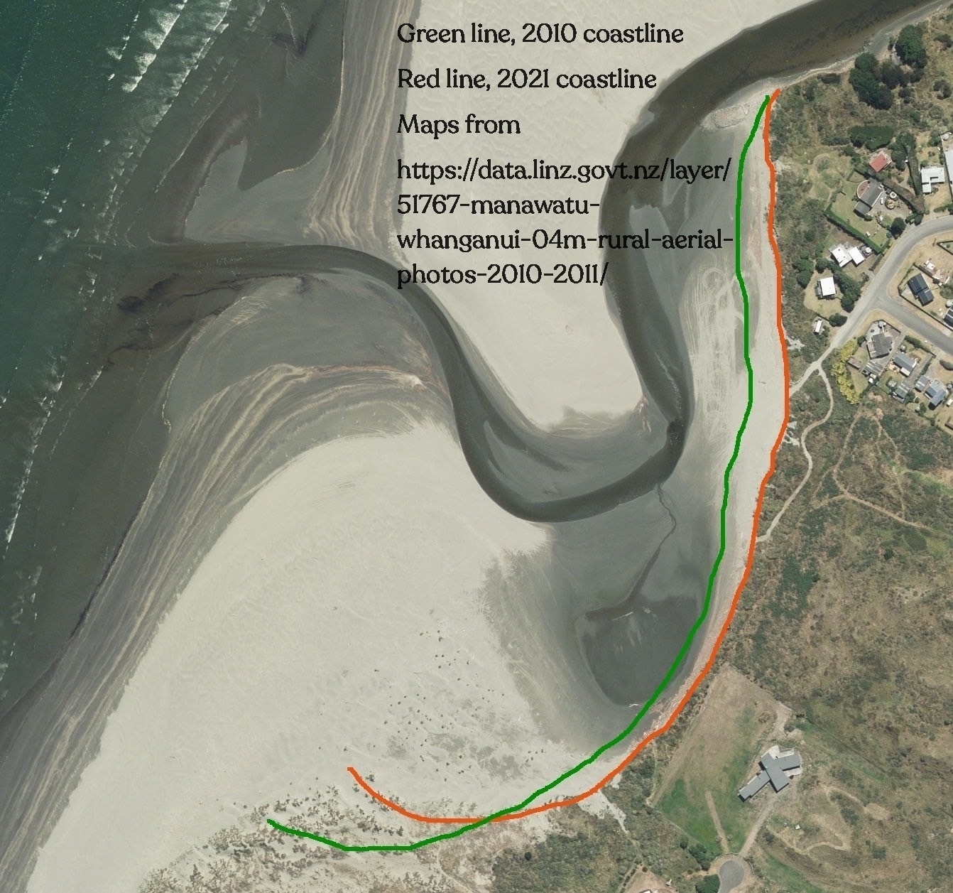
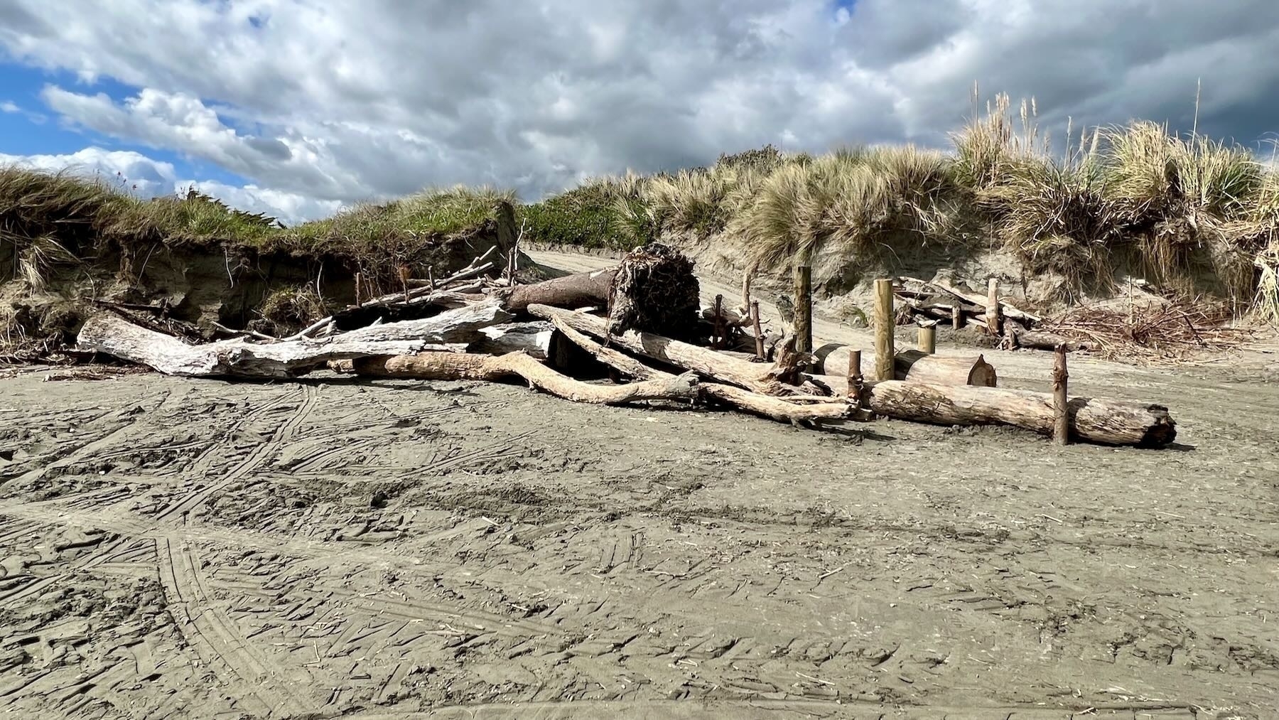
It’s almost exactly 6 years since ex-Tropical Cyclone Gita swept away many metres of sand from the front of the estuary. In early 2018 the whole stretch from the groyne to outside the north end of Reay Mackay Grove lost many metres of sand in just a few days of high winds, high tides and high river flow.
See: Ex Tropical Cyclone Gita severely eroded the estuary frontage, February 2018, published 21 February 2018.
Also see the Tonkin Taylor report March 2019: Waikawa Beach geomorphological assessment. A report prepared for Tonkin and Taylor Ltd on behalf of Horizons Regional Council. By Dr Roger D Shand
which talks about Approximately 20m dune erosion (setback) in front of 55–63 Manga-Pirau Street in the past 5- 6 years
. See below for a link to the report.
It’s easy for anyone who pays the slightest attention to know that that area has eroded significantly since then. With every big storm and high tide more sand is lost.
An article today on RNZ talks about similar erosion on the East Coast from a different Cyclone:
New research a year on from Cyclone Gabrielle shows parts of the East Coast's shoreline are the most eroded they have been in decades.
Scientists at the University of Auckland have found parts of the coast have more than 10 metres of erosion, and in the case of Mahanga Beach north of Māhia, 20 metres was carved away. …
The storm surge caused huge waves which carried sand off the beach and out to sea. Most of the erosion happened during a single high tide, over the space of hours.
"What happens when a storm typically passes through is you get instantaneous erosion, and then it takes a long time for the beach to recover. Given we've lost a lot of dune, it takes a long time for that sand to make its way back up onto the beach and build the dune back out as a healthy buffer."
Source: Cyclone Gabrielle: Parts of East Coast lost 10 metres of shoreline, research shows | RNZ News.
Horowhenua District Council will soon be consulting on their Long-Term Plan. As a community we should be asking them to plan for the expected erosion along the estuary frontage. The current track across private land is now only about 35 metres long (or less). We could reasonably expect that to disappear within the next decade or two.
With climate change and rising sea levels we can expect big storms to carry more rain and to more often ‘stall’, dropping more rain in one place.
There were another interesting couple of paragraphs in the news item quoted above (my emphasis):
“Commercially, they’ve been operating these very high resolution satellites for about the last 20 years, but it’s probably only been over the last four or five years that the cost has come down, and the accessibility got to the point where you can order an image on your phone… or you can actually pay a little bit more and task a satellite to be over your beach at a particular time and take an image.”
He said it cost academic buyers about $20 per square kilometre. The higher the resolution, the higher the cost, but it was a gamechanger for scientific research, he said.
The HDC are very hard pushed for project funds at the moment (and we’re facing the prospect of a 17% rates rise because of it). But perhaps they could spare a bit from the budget to have satellites monitor that specific stretch of coast, at least annually.
Read the full Tonkin and Taylor report (13.5 MB, PDF), or optionally, read Miraz’s plain language notes (42 KB, PDF).