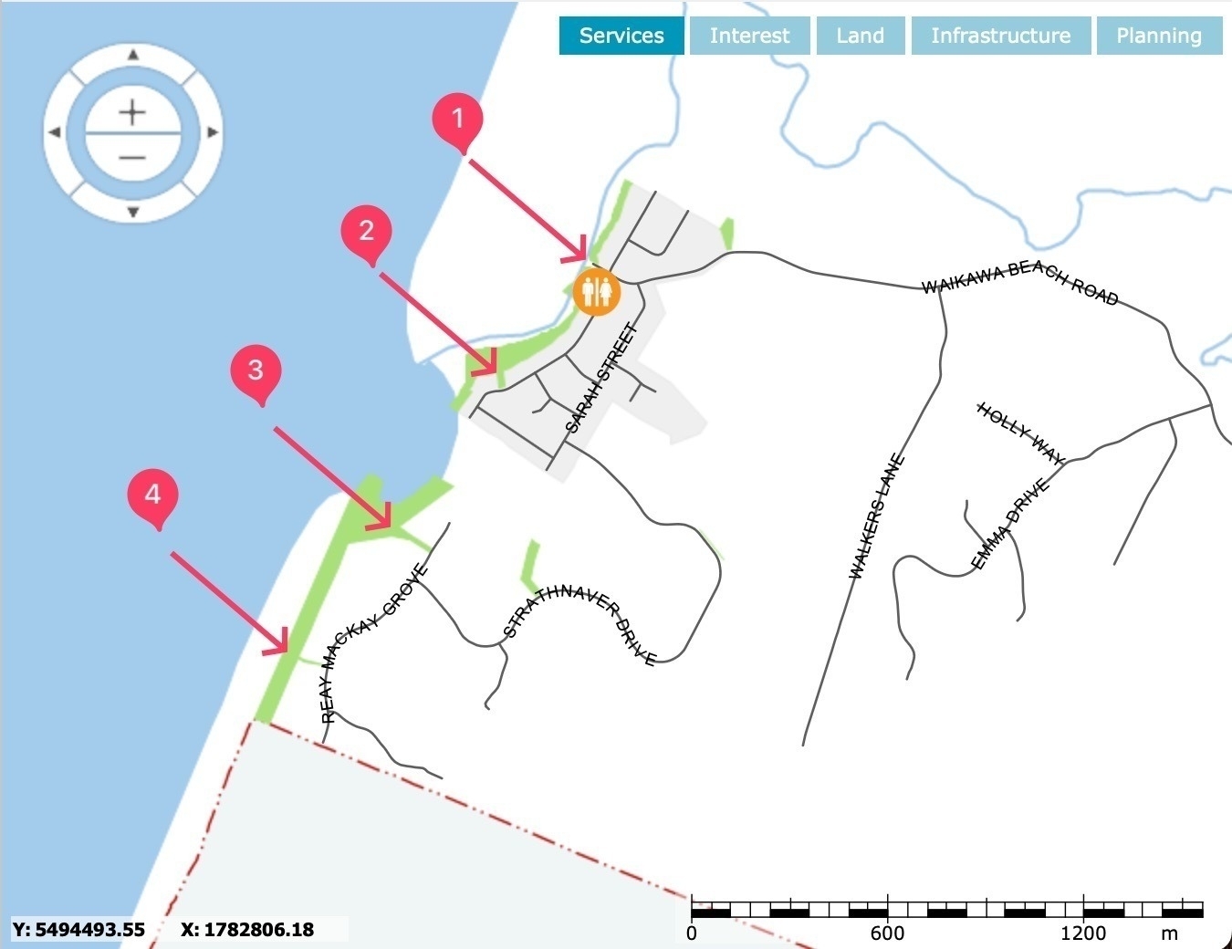
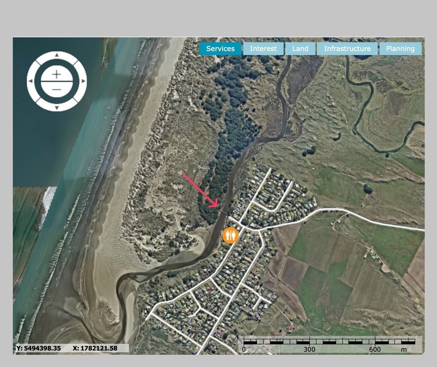
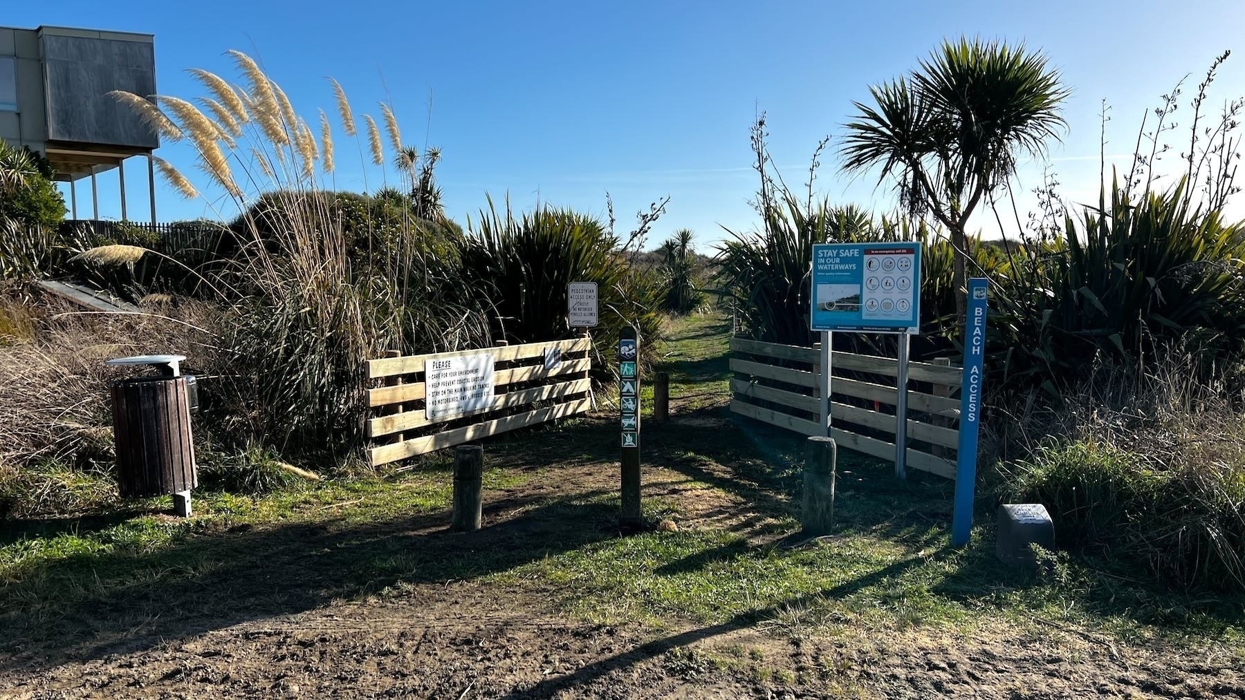
New residents and visitors may be confused about where and how to get onto the beach now that the Manga Pirau Street access is fenced off.
While there is no access for vehicles, or for horses, pedestrians have 4 options, two in the village and two in Strathnaver.
Rubbish bins and dog poop bag dispensers are available at the footbridge and at the Reay Mackay Grove tracks.
Please remember to stay off the dunes, apart from the marked tracks and to remove all litter. Please also pick up after your dog and put the bag in the bin.
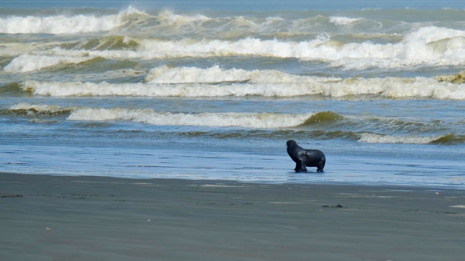
Note that sometimes, especially in wintry months, you may come across seals on the beach. Give them a wide berth, don’t get between the seal and the sea, and keep dogs away. From a distance seals can look like driftwood or dogs.
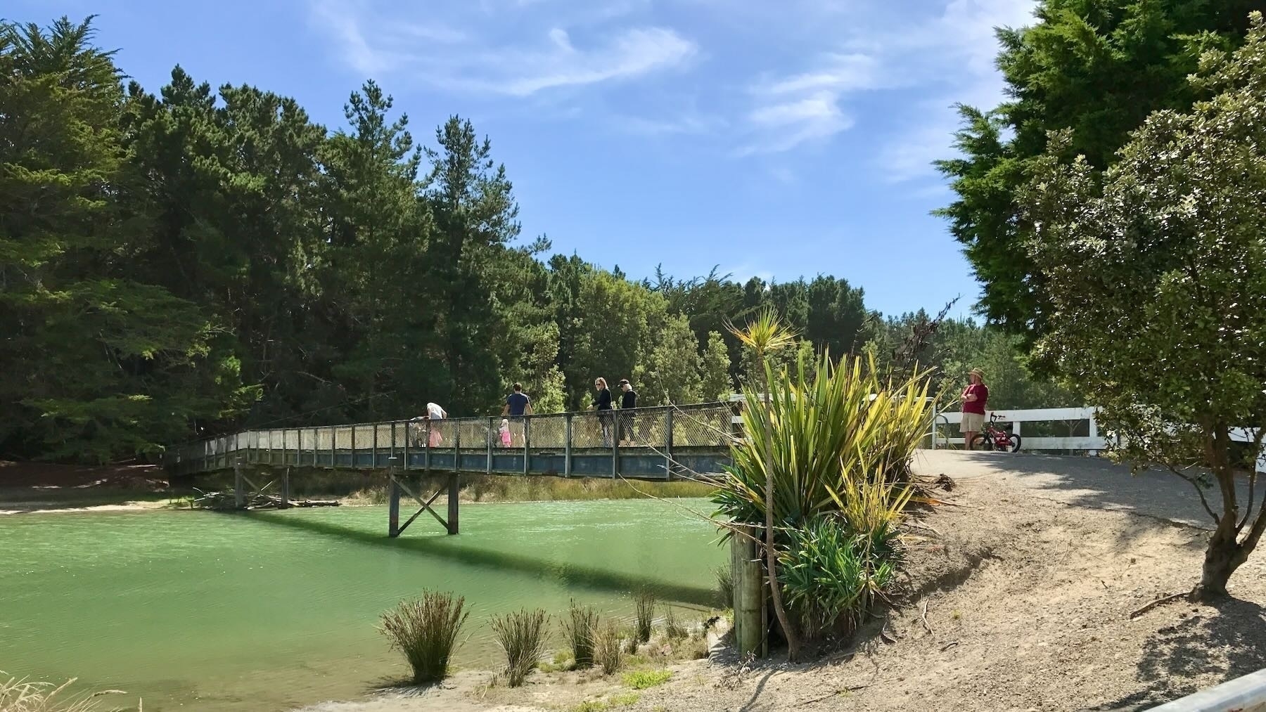
1. Across the footbridge
Go to the end of Waikawa Beach Road next to Hank Edwards Reserve. (Note there are carparks and bike stands available, and toilet facilities in Hank Edwards Reserve.) Cross the footbridge, then either stroll through the trees or turn left to walk beside the river. Much of the land is privately held, but the owners generously allow the public access. This area is north of the river.
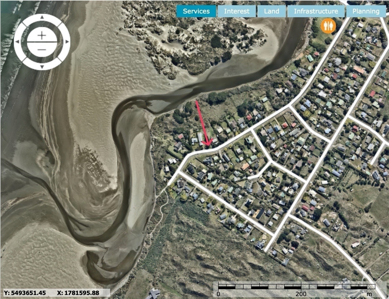
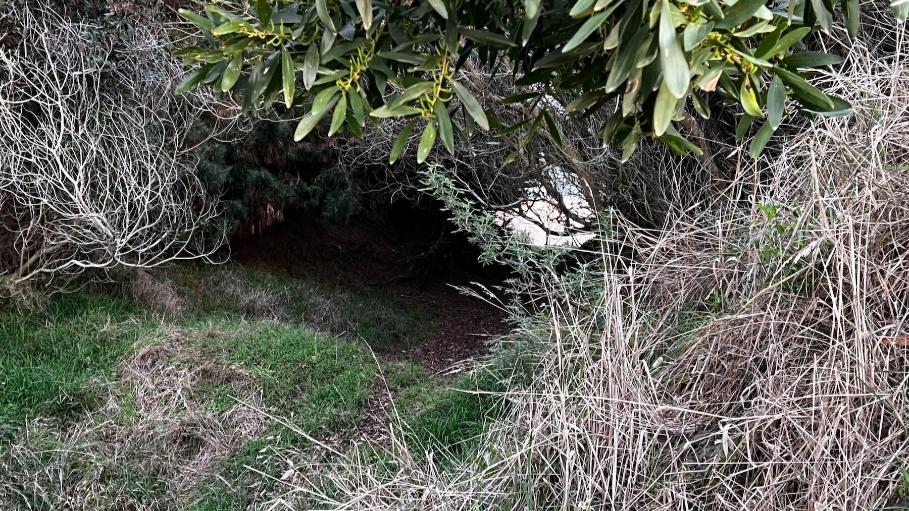
2. Between 47 & 49 Manga Pirau Street (not recommended)
If you are prepared to bash through undergrowth, walk on uneven surfaces, and can handle riverside rocks then this track will bring you out next to the groyne if you turn left when you reach the river. People do walk through here sometimes, so there’s a bit of a track to follow. The track may become clearer over time as people use it more.
The entrance looks like an empty section between numbers 47 and 49 Manga Pirau Street, as marked on the map. This area is south of the river.
To reach Reay Mackay Grove go the full length of Strathnaver Drive (about 2 Km), off Sarah Street. Then either turn right to #10 or left to #60.
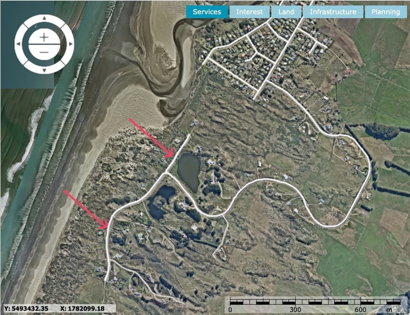
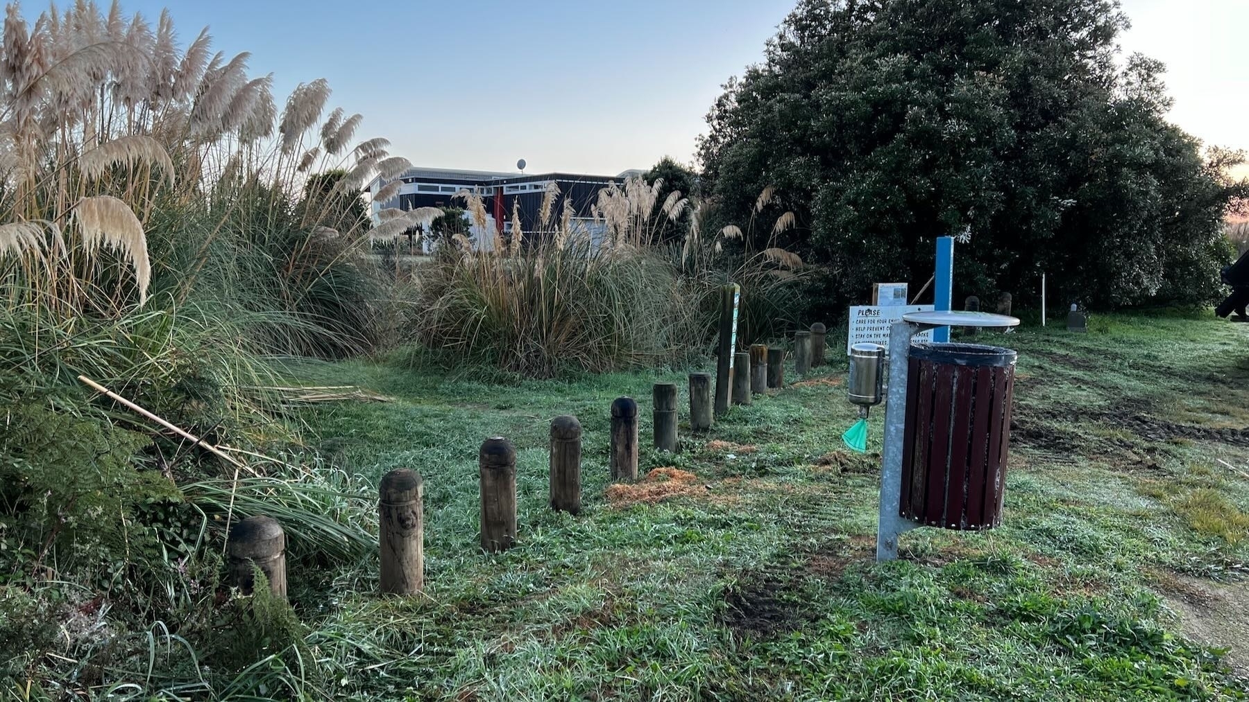
3. Number 10 Reay Mackay Grove (north end)
This track has become rather long over recent years, but can bring you out right beside the estuary. A south branch lets you go onto the beach a tad further away from the river.
The dunes in this area are accreting and annual spinifex plantings are building the area too.
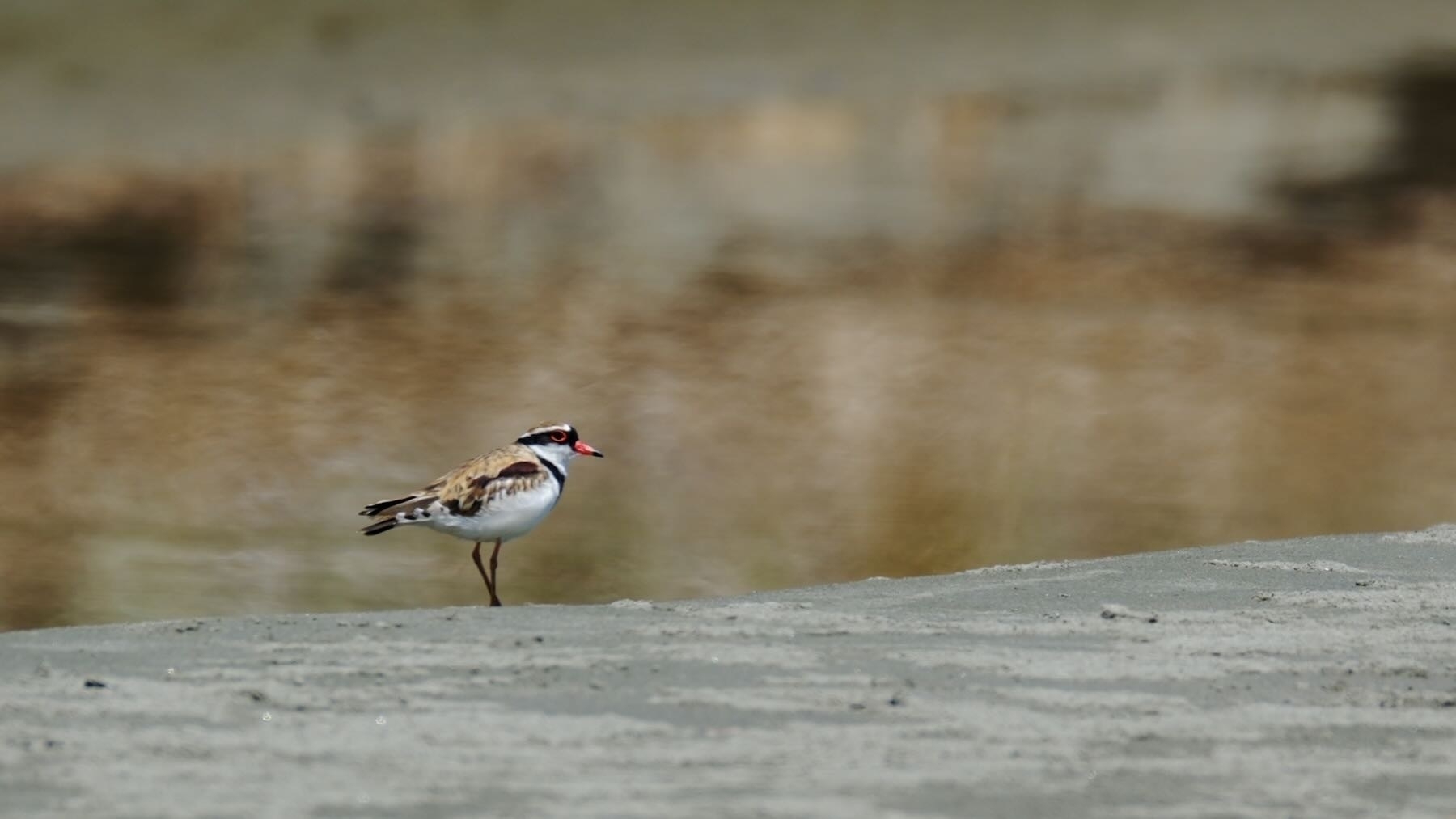
Birds also nest in this general area. Over summer beware Pied Stilts, who nest nearby, divebombing you.
Around here you are very likely to see Pied Stilts, Oystercatchers and Dotterels — NZ Dotterel, Banded Dotterel and Black-fronted Dotterel. You may also spot white-faced heron, paradise shelducks, spur-winged plovers, along with magpies, swallows and other birds — it depends a bit on season.
This area is south of the river and bike stands are available.
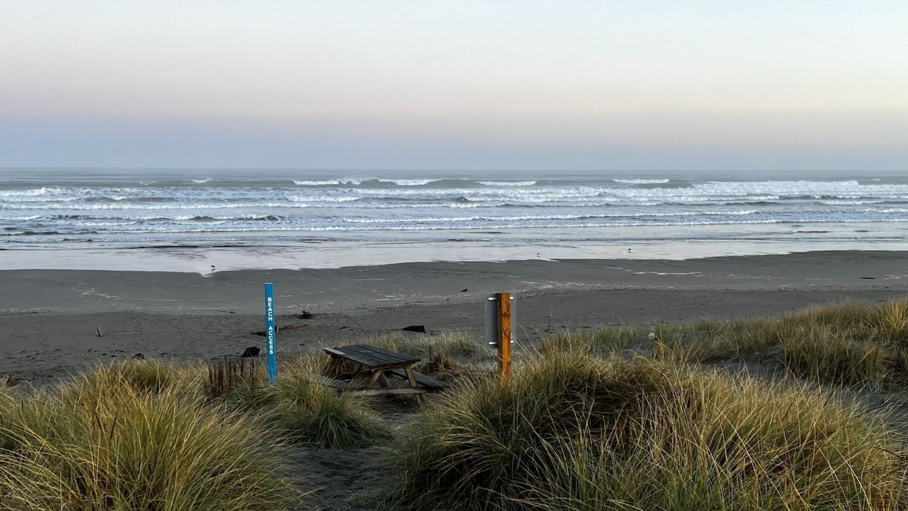
4. Number 60 Reay Mackay Grove (south end)
This track is a good choice for many people as it’s relatively short and easy. People often swim or picnic on the area of the beach where this track exits.
There is a picnic table at the beach end where you can sit and enjoy the view.
This area is south of the river.