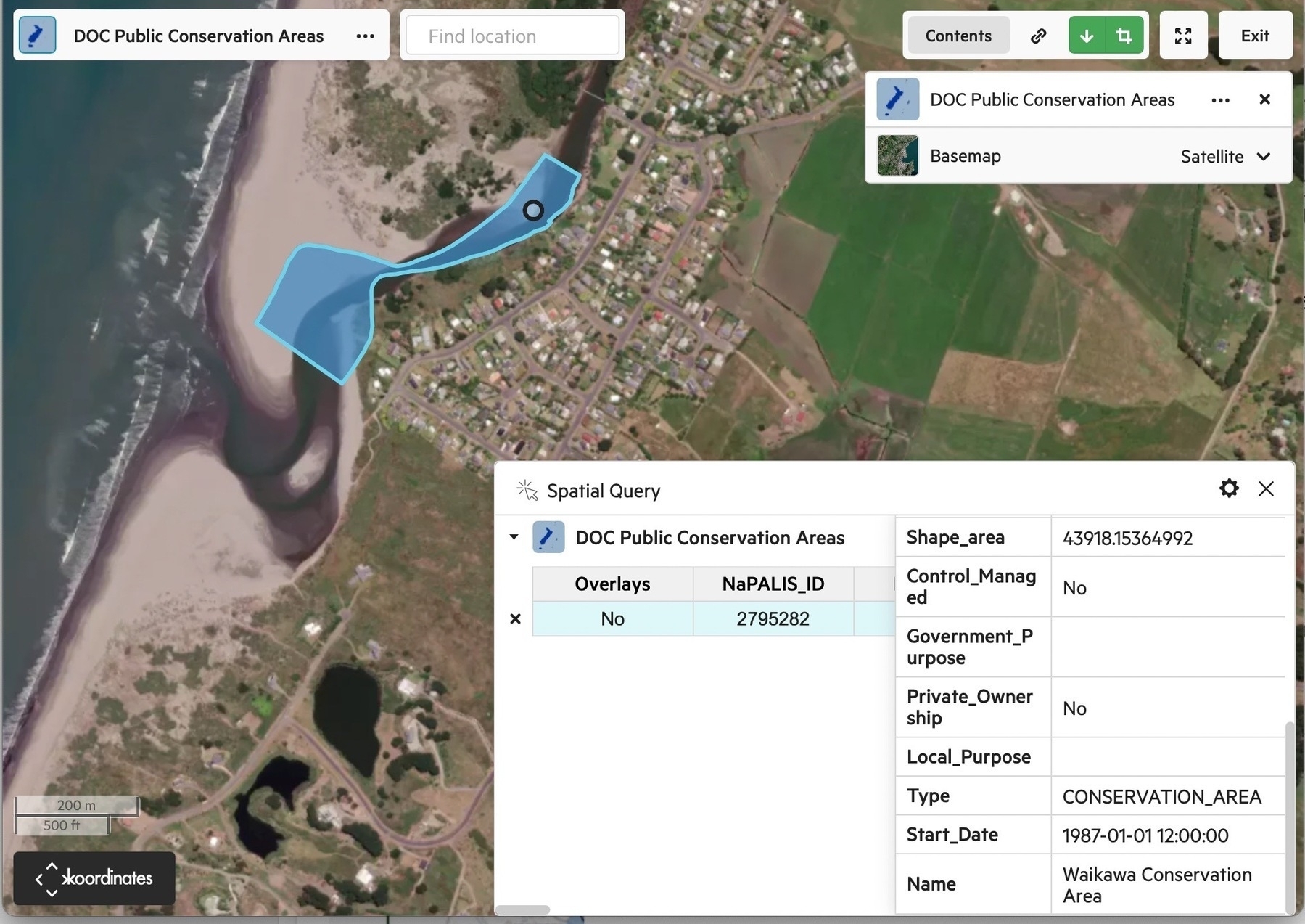
When looking again at the reports from Boffa Miskell, carried out in response to the vehicle access petition, I noticed something I'd overlooked before: a DOC controlled Waikawa Conservation Area that runs along the river beside the village, and includes the groyne area.
This is an officially protected area:
NaPALIS ID: 2795282
Protected Area Name: Waikawa Conservation Area
Area (ha) 4.39
Legal Description: Stewardship Area - s.25 Conservation Act 1987
When we check the Act we find — Conservation Act 1987 No 65 (as at 23 December 2023), Public Act Part 5 Stewardship areas – New Zealand Legislation:
Management of stewardship areas
Every stewardship area shall so be managed that its natural and historic resources are protected.
Whoever has been driving vehicles down through HDC land and into the recently planted protective spinifex (killing several square metres) to exit beside the groyne has transgressed against the Conservation Act 1987 …
