It’s a bit hard to define Waikawa Beach
— sometimes it just means the sand and dune area near the water’s edge — the beach
.
Sometimes it means the community and structures in the Waikawa Beach area.
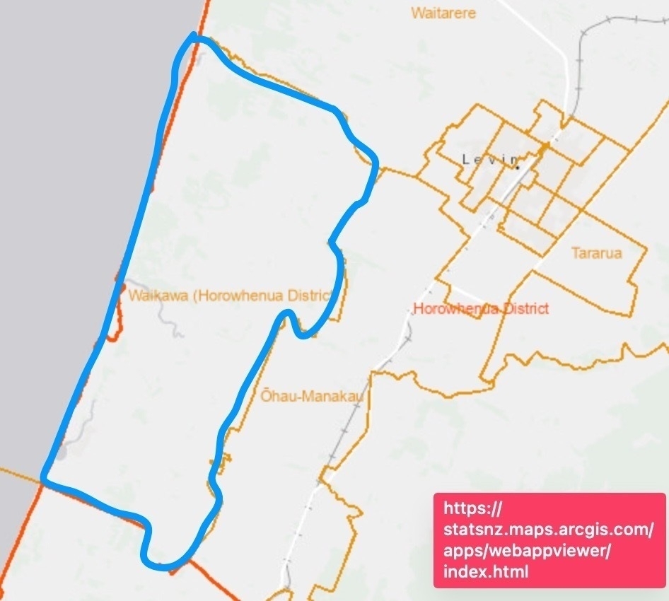
For statistical purposes Stats NZ define the Waikawa Beach area as roughly a rectangle that stretches all the way up to Hokio Beach Road and across to roughly Takapu Road.

That’s definitely not what I mean by Waikawa Beach.
So, how about defining it as the properties (and people who use them) reached after the village entrance on Waikawa Beach Road. That’s not bad, but what about all the folks at Emma Drive and environs?
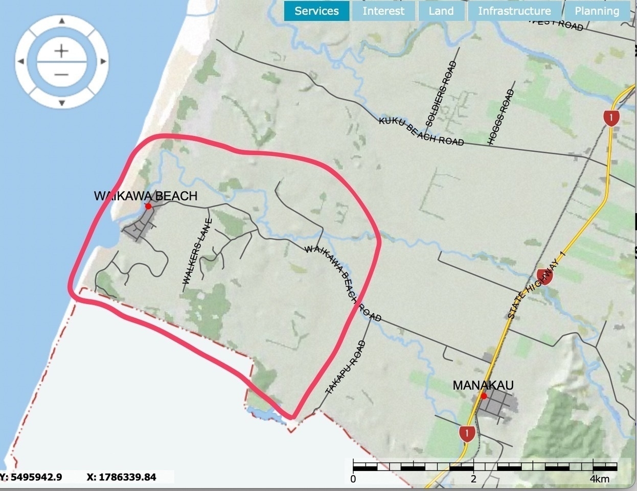
For me Waikawa Beach refers to all the properties (and people) reached west of Takapu Road, and requiring Waikawa Beach Road as part of their access.

For me, that leaves Takapu Road and places east to belong to Manakau and the rest as part of 'our' community. Your definition, of course, may differ.
How many properties at Waikawa Beach?
It’s common when people discuss Waikawa Beach issues to ask: “How many people live (permanently / part time) at Waikawa Beach?” Or “How many properties are at Waikawa Beach?”
The first question seems unanswerable, though Stats NZ should be able to tell us, perhaps if approached directly, and noting how they define the statistical area. It would be worth waiting till the 2023 census results are available, and there may be a fee to get the specific data for a closer definition of Waikawa Beach. I’ll leave that task to someone with funds available for that kind of query.
There is some hope with the second question though: how many properties?
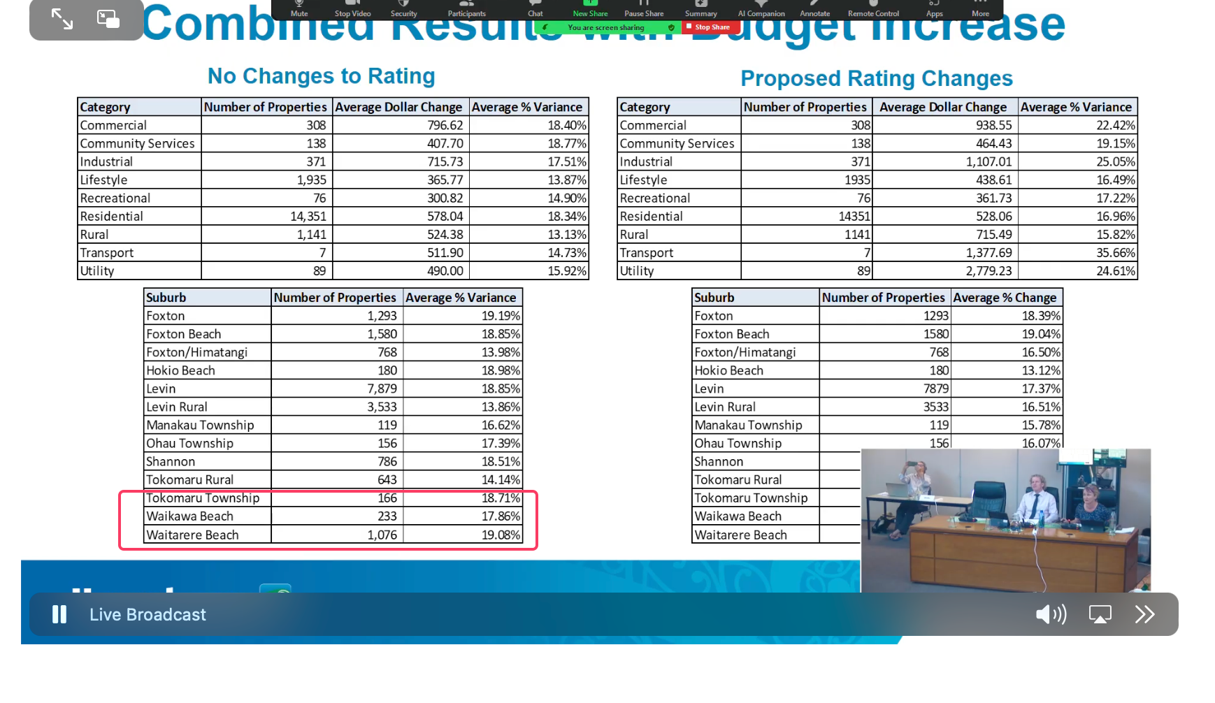
While watching an HDC livestream of a workshop on Wednesday 31 January 2024 I noticed one slide that listed Waikawa Beach as having 233 properties. That was interesting, so I emailed and asked for clarification.

Daniel Minty HDC Financial Services Manager replied:
The properties in the slide include the below streets so is quite limited to the village areas of Waikawa Beach. For this reason I would not recommend using the total if you were looking for a more exact figure as there is likely rural properties you (or the community) would consider to be part of Waikawa Beach we do not have as such in the rating database.
- Waikawa Beach Road, Waikawa Beach
- Drake Street, Waikawa Beach
- Arthur Street, Waikawa Beach
- Manga Pirau, Street Waikawa Beach
- Sarah Street, Waikawa Beach
- Cathryn Street, Waikawa Beach
- James Street, Waikawa Beach
- Duncan Street, Waikawa Beach
- Norna Grove, Waikawa Beach
- Sand Dune Grove, Waikawa Beach
- Mavis Avenue, Waikawa Beach
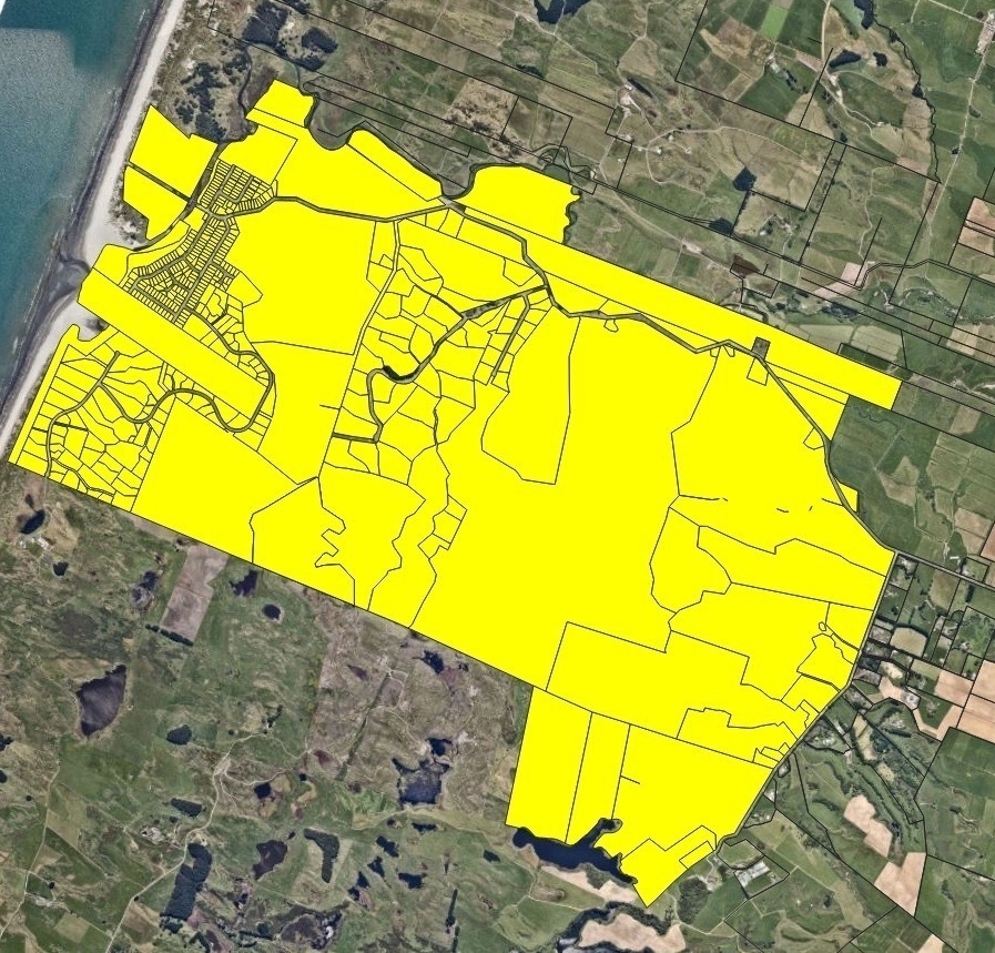
If you could define an area I may be able to ask our GIS mapping team to come up with a total for you?
I responded with my map shown above and on 02 February 2024, Daniel Minty emailed:
Our GIS mapping team have come back with 424 rating assessments across the selected area below. One additional caveat I have to add is that one rating assessment doesn’t equal one property (or dwelling) as you can have multiple properties on one rating assessment I.E a house and a granny flat but that probably a good estimated figure to use?

Clearly there are some properties where there are no dwellings (for example, the land across the footbridge) and there are some big farms. If we assumed 75% of the 424 rated properties contained a dwelling of some sort that would give us 318 houses / baches.
That’s something to chew on.
Interesting tidbit: according to Page 25 of the book Bitter Water in 1845 the local population numbered several thousand people
. Bitter water : a story of Waikawa, by Deb Shepherd and Laraine Shepherd, 1999, ISBN 0473064855.