A report in the NZ Herald on 18 October 2023 about vehicle access at Waikawa Beach:
For more than 50 years, through the goodwill of a private landowner, the sole public entrance to the beach is at the end of Manga Pirau St. But a river mouth prone to changing shape in wind and tide was more frequently preventing vehicle access at the entrance.
Some of that goodwill was eroded after a 2021 weather event blocked access and a member of the public took the liberty of creating their own access through the land, without consent, using heavy machinery.
The date on the weather event and unconsented access is incorrect above (it was incorrectly mentioned in the meeting — the reporter simply recorded the incorrect mention). The illegal track was cut in 2018 after ex-Tropical Cyclone Gita cut access. See The morning after Ex-TC Gita, published on: Wednesday, 21 February 2018 for photos.
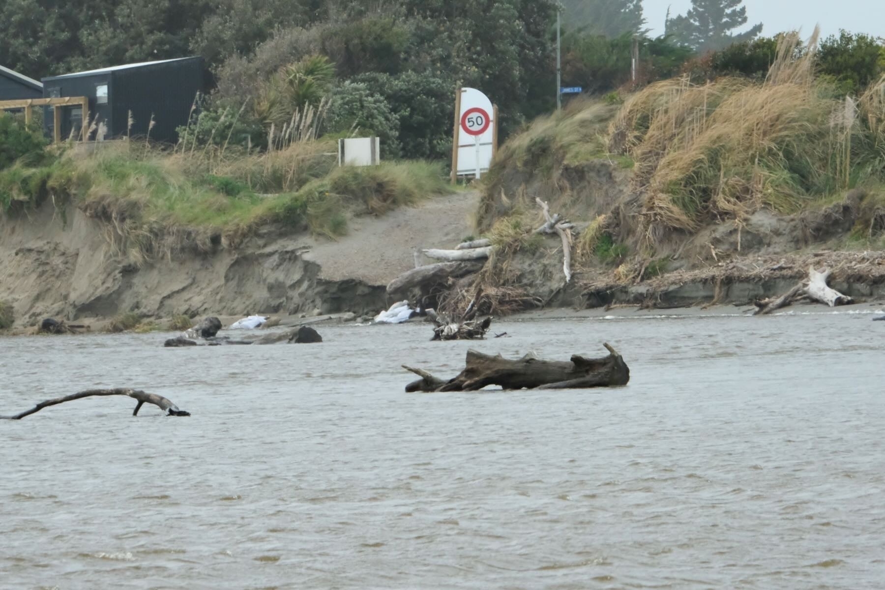
Something I’d forgotten was that in that storm Debris came 10 metres up the south beach track off Reay Mackay Grove
. On the Strathnaver side the beach was swept clear right up to the base of the dunes.
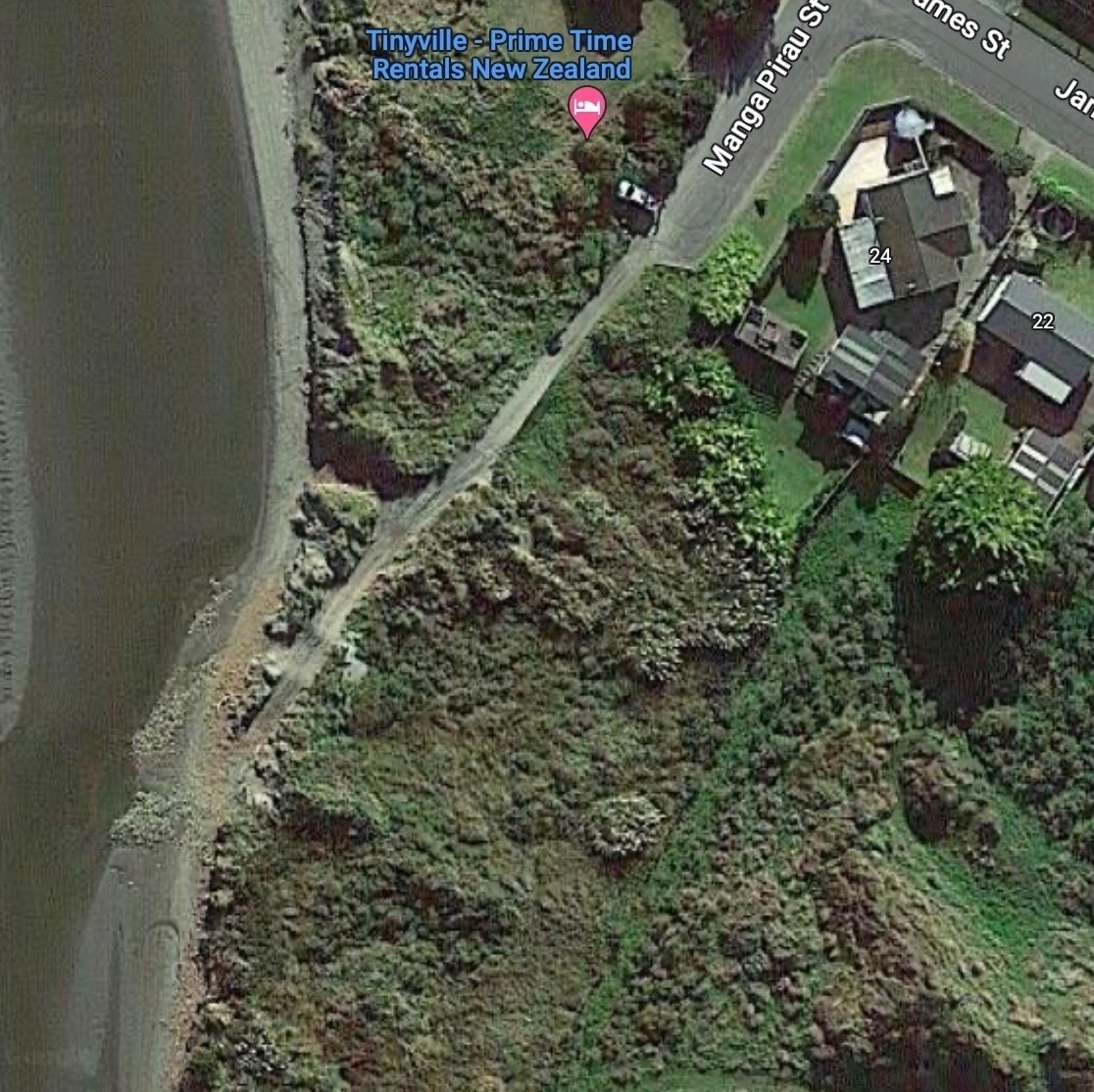
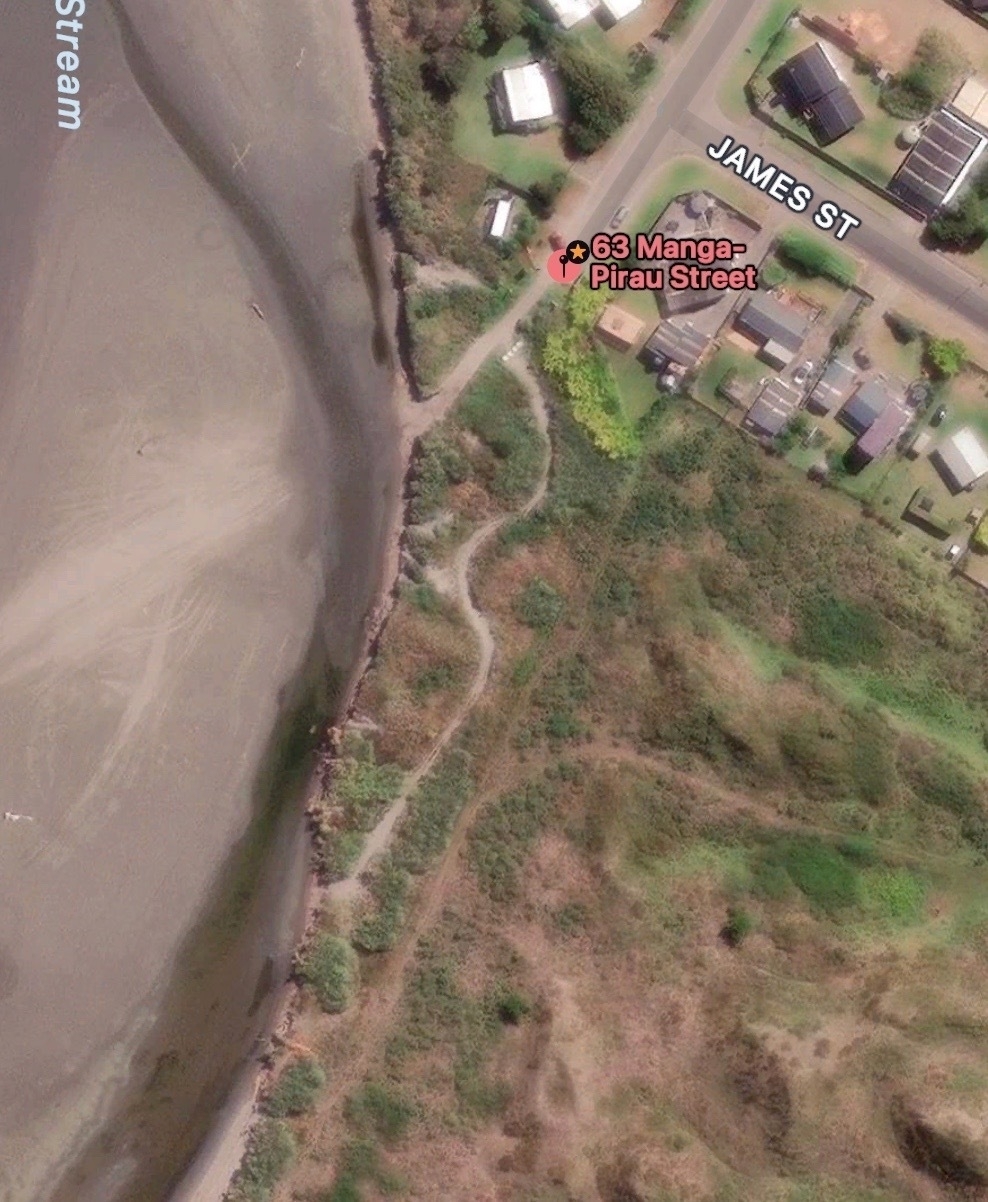
That illegal track someone cut through private land without asking the owners is still unmissable on satellite photos. The first screenshot is from Google Maps which is outdated and shows imagery from before Gita. The second is from Apple Maps which is much more recent.
It’s hard to understate how damaging that illegal track was for both the land it destroyed and the community at large, as well as for the goodwill of the landowner. Some members of the community continued to use the track even when asked not to and even when the track was blocked in ways they could get around. That led to HDC installing concrete bollards to block the track, and sometimes the whole access.
There is a direct link between that behaviour and ill-will from some in the community who were already not very much in favour of vehicles even being allowed to be on the beach in the first place. The bad behaviour was polarising.
As a consequence HDC has added an item to the public consultation on vehicle access for Waikawa Beach: should it be completely removed? See Vehicle access, next steps and a small correction, published on: Friday, 13 October 2023.
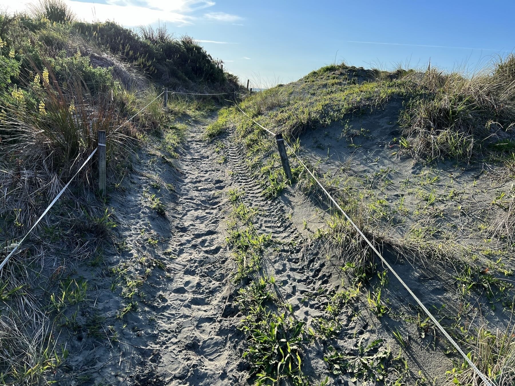
With access currently cut off after very high tides and wind, some may take it into their heads that they can simply drive across the pedestrian-only tracks off Reay Mackay Grove. The first recent instance I’ve seen was on Wednesday 18 October 2023.
If drivers continue to use illegal means to access the beach the chances that the public will voice clear opinions to totally ban vehicle access from Waikawa Beach are very high indeed.
Those who want to retain access through the Manga Pirau Street track should rein in the more lawless in the community. Leave pedestrian tracks to the pedestrians, talk to HDC about options for restoring the washed-out track. The river has already retreated again and flows more directly out to sea now.