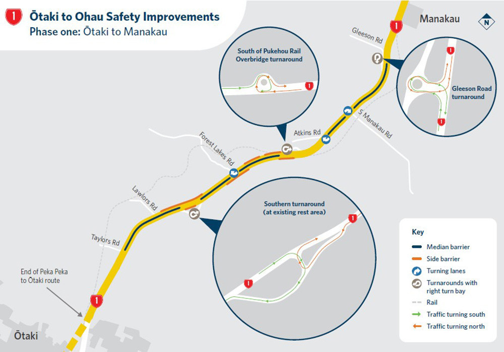
In response to the post Roadworks from Ōtaki to Ohau a reader asked about the three Turnarounds. I put the question to Waka Kotahi and received a useful reply. In brief: the turnarounds allow people to reach addresses along the way if they’re travelling from the ‘wrong’ direction. Median barriers will prevent some turns we might currently be able to make.
The question:
I still do not understand what these ‘turnarounds’ are for!! What is the purpose of them? I understand we can turn in there and turn around but why?? Is it some future planning for the new highway O2NL? It's a pretty expensive project just for the travellers who missed a turnoff
The Waka Kotahi response:
As more median barrier is installed across New Zealand, turnaround bays will become more common. Where there are median barriers, drivers may need to travel a bit further to turn right, or to turn around to access a road or driveway. The turnarounds between Ōtaki and Manakau will provide people driving, including in larger vehicles, a place to turn safely.
When median and side barriers are installed, they reduce the number of people killed by up to 90%. If a driver hits a flexible barrier, the steel cables flex and so slows down the vehicle to keep it upright, absorbing the impact so the those in the car don’t. Side barriers keep you from hitting more significant hazards like poles, trees or drainage ditches.