A NIWA Media Release, 25 May 2023, explains about new maps showing possible coastal inundation under extreme circumstances.
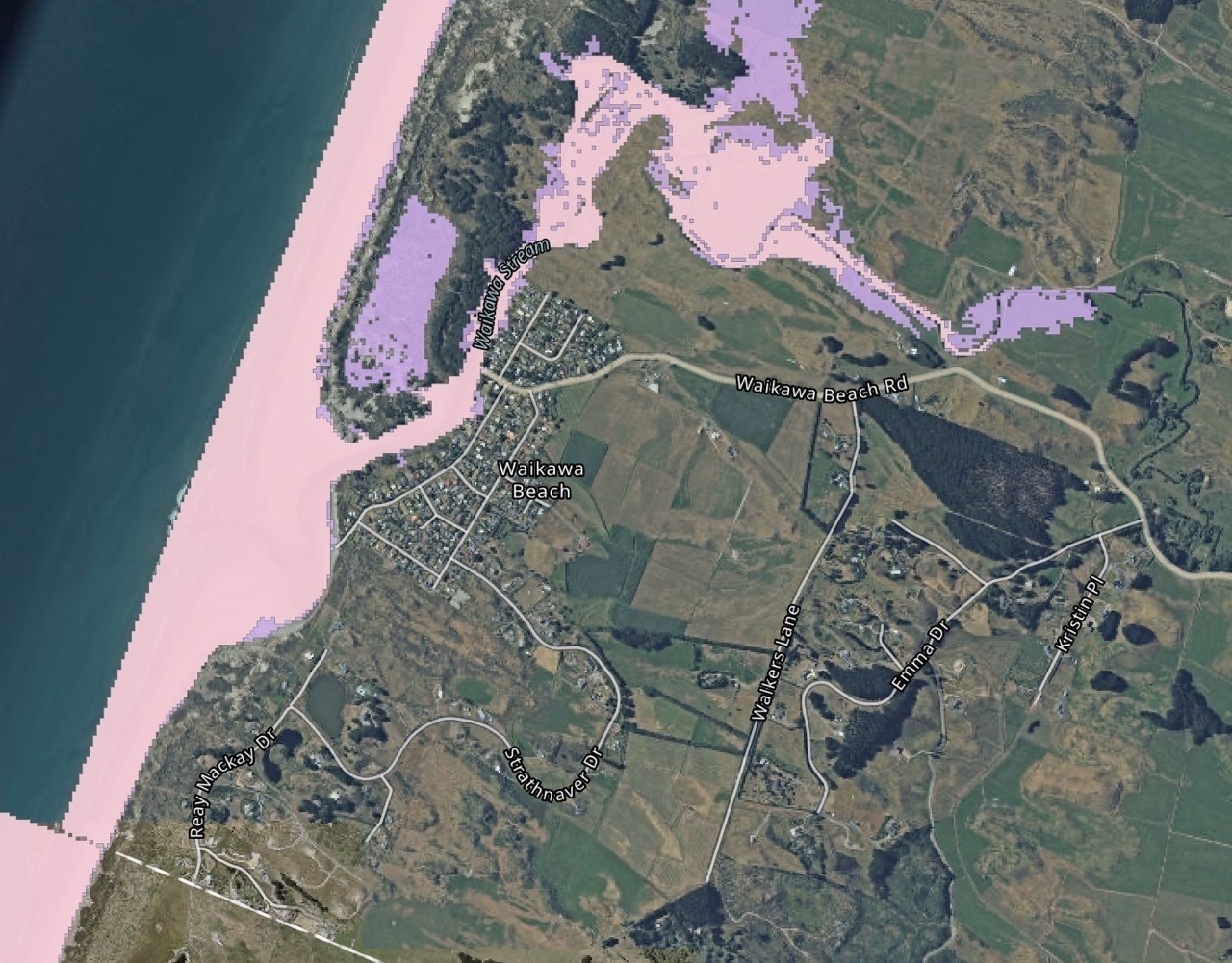
The map below shows potential inundation with 40 cm sea level rise (by 2065) if high tides, storm surges and large waves occur simultaneously. It seems that Hank Edwards Reserve (which has already partially flooded during big storms) and areas around Drake Street would be most at risk, along with farmland and dunes around the river.
New maps from NIWA and the Deep South National Science Challenge show areas across Aotearoa New Zealand that could be inundated by extreme coastal flooding. They show a large storm-tide with the sea-level rise that we are likely to see with climate change. …
Coastal flooding is particularly likely when high tides, storm surges and large waves occur simultaneously. At these times, low-lying areas are inundated when high seas overtop or even break barriers, and cause rivers to back up inland.
This can destroy property, infrastructure, and be a danger to life, as well as having severe impacts on the natural environment and ecosystems. …
The research found that small amounts of sea-level rise will drive a rapid increase in cumulative flooding from increasingly frequent coastal-flood events-nationally, and 30% more land area would be regularly flooded after 0.3m relative sea-level rise.
"By 2065, there could be 0.4m of sea-level rise, based on the current trajectory, or sooner where the landmass is subsiding," said Dr Stephens.